S-36: Difference between revisions
Pbcjohnston (talk | contribs) Added photos |
Pbcjohnston (talk | contribs) Finished adding photos and captions |
||
| Line 37: | Line 37: | ||
[[File:S-36 torps canopus.jpg|left|500px]] | [[File:S-36 torps canopus.jpg|left|500px]] | ||
<div style="text-align: justify;"><span style="color:#00008B">S-36 in the process of receiving | <div style="text-align: justify;"><span style="color:#00008B">S-36 in the process of receiving new Mk 10 torpedoes from the submarine tender Canopus (AS-9). Date and location is not known for sure, but it is probably on the China Station in 1926-1929 time frame. | ||
<small>Photo provided by MMCM(SS) Rick Larson, USN (Ret.)</small> | <small>Photo provided by MMCM(SS) Rick Larson, USN (Ret.)</small> | ||
| Line 51: | Line 51: | ||
[[File:S-36 china black.jpg|left|500px]] | [[File:S-36 china black.jpg|left|500px]] | ||
<div style="text-align: justify;"><span style="color:#00008B">S-36 seen here off Tsingtao, China approximately 1939-1940. Mooring lines are faked out on deck and even over the radio antenna support wire. The maneuvering watch has been stationed and line handlers are ready. On the bridge, either the Captain | <div style="text-align: justify;"><span style="color:#00008B">S-36 is seen here off Tsingtao, China approximately 1939-1940. Mooring lines are faked out on deck and even over the radio antenna support wire. The maneuvering watch has been stationed and line handlers are ready. On the bridge, either the Captain or the Officer of the Deck is sitting on the top of the periscope shears. | ||
The boat has been brought up to date by this photo, with the "new" black paint scheme and the post S-4 safety modifications. In 1938 the Navy standardized on using just the hull number for external visual identification, replacing numerous other confusing schemes that had prevailed since 1920. | |||
S-36 would be in a very similar configuration on January 20, 1942 while on patrol in the southern end of the Makassar Strait off | |||
Celebes. At 0404 she ran hard aground on Taka Bakang Reef. The weather had been foul for many hours, preventing the Navigator from getting a good fix. At the time of the grounding she was operating off an hours old dead reckoning position plotted on faulty and incomplete charts. The crew labored for hours, trying every trick in the sailor's book to get her off the reef. Eventually they had to admit the boat was a total loss. Fearing nearby Japanese activity, the entire crew was evacuated to safety in Makassar City. The wreck was quickly broken up by sea action on the reef, scattering parts into both shallow and nearby deep water. Any parts remaining above water were most likely used by both Japanese and Allied forces as a convenient training target in the hotly contested waters of the Makassar Straight. Little if any parts of the wreck would remain today. | |||
<small>Photo from the private collection of Mike Kaup. Used with permission.</small> | |||
[[File:Red bar sub new.jpg]] | [[File:Red bar sub new.jpg]] | ||
Revision as of 18:06, 16 August 2023

USN Photo courtesy of Ray 'Oldgoat' Stone.
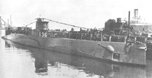
U.S. Navy photo.
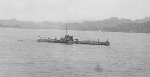
Photo in the private collection of Ric Hedman.

Photo in the private collection of Ric Hedman.

Photo in the private collection of Ric Hedman.
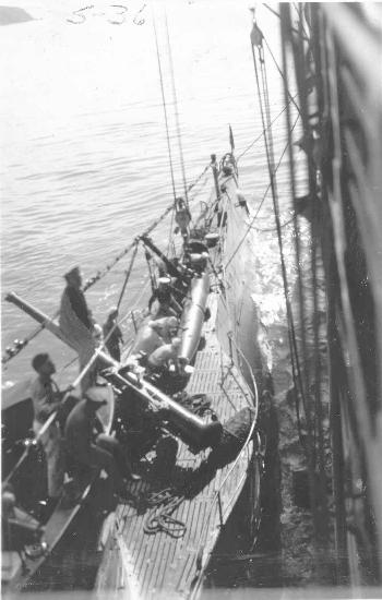
Photo provided by MMCM(SS) Rick Larson, USN (Ret.)
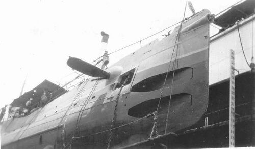
Photo provided by MMCM(SS) Rick Larson, USN (Ret.)
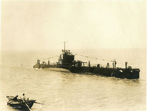
The boat has been brought up to date by this photo, with the "new" black paint scheme and the post S-4 safety modifications. In 1938 the Navy standardized on using just the hull number for external visual identification, replacing numerous other confusing schemes that had prevailed since 1920.
S-36 would be in a very similar configuration on January 20, 1942 while on patrol in the southern end of the Makassar Strait off Celebes. At 0404 she ran hard aground on Taka Bakang Reef. The weather had been foul for many hours, preventing the Navigator from getting a good fix. At the time of the grounding she was operating off an hours old dead reckoning position plotted on faulty and incomplete charts. The crew labored for hours, trying every trick in the sailor's book to get her off the reef. Eventually they had to admit the boat was a total loss. Fearing nearby Japanese activity, the entire crew was evacuated to safety in Makassar City. The wreck was quickly broken up by sea action on the reef, scattering parts into both shallow and nearby deep water. Any parts remaining above water were most likely used by both Japanese and Allied forces as a convenient training target in the hotly contested waters of the Makassar Straight. Little if any parts of the wreck would remain today.
Photo from the private collection of Mike Kaup. Used with permission.
Page created by:
Ric Hedman & David Johnston
1999 - 2023 - PigBoats.COM©
Mountlake Terrace, WA, Norfolk, VA
webmaster at pigboats dot com
